
Pļaviņas 5-day weather forecast
 3°
Weather forecast Pļaviņas today Nov 12, 2026: overcast, temperature from 1 °C to 3 °C.
Precipitation probability 54%. Wind up to 5.5 m/s (gusts 12.11 m/s). Air humidity 79–97%, atmospheric pressure 746–753 mm Hg, UV index up to 0.6.
Weather Alerts
Dzeltenais vēja brīdinājums
12.11.2026. no rīta Rīgas līcī dienvidu, dienvidaustrumu vējš pastiprināsies brāzmās līdz 15-18 m/s. Viļņu augstums 1.0-2.0 m.
Dzeltenais vēja brīdinājums
12.11.2026. nakts otrajā pusē Baltijas jūras centrālajā daļā dienvidrietumu, dienvidu vējš pastiprināsies brāzmās līdz 15-20 m/s. 12.11. dienā austrumu daļā vējš iegriezīsies no dienvidiem, dienvidaustrumiem. Viļņu augstums 2.0-3.0 m.
Dzeltenais miglas brīdinājums
11.11.2026. nakts pirmajā pusē vietām Latvijas austrumu daļā ir izveidojusies migla ar redzamību 500-1000 m, kas saglabāsies arī no rīta. ESI INFORMĒTS par miglu, kas skar plašas teritorijas, atsevišķās vietās tā var būt ļoti bieza!
Migla var ietekmēt ikdienas gaitu aktivitātēm, kas paredzētas ārā. Tiks traucēta transporta kustība uz ceļiem, kā arī gaisa satiksme. Ieplāno ilgāku laiku ceļam.
Miglas dēļ var būt pasliktināta gaisa kvalitāte, jo sevišķi pilsētās.
Wind gusts up to 18 m/s are expected
Moderate wind warning
We expect strong wind in district Šaľa.
Wind gusts can reach 18 m/s (65 km/h).
This wind speed represents potential risk for human activities.
BE AWARE of debris being blown around. Localised outdoor activity disruption is possible due to debris.
Rain with precipitation amount up to 40 mm is expected
Moderate rain warning
We expect rain of 30 - 40 mm in district Šaľa.
This amount of precipitation represents potential risk for human activities.
BE AWARE of the potential for localised flooding of a small number of properties, with local disruption to outdoor activities.
Difficult driving conditions due to reduced visibility and aquaplaning.
5 days at a glance — tap a day to open it
Sunrise 07:50
Sunset 16:12
Sunset 16:12
Waxing Crescent14% illuminated
Moonrise 12:17 · Moonset 17:26
Moonrise 12:17 · Moonset 17:26
Chart
TableThu, Nov 12, 2026
Forecast from 1 °C to 3 °C and precipitation
Cloud cover and precipitation probability
Wind speed and direction
Air humidity
Atmospheric pressure
Ultraviolet index
Air quality & pollen
Thu, Nov 12, 2026
Frequently asked questions about the weather in Pļaviņas
What is the weather in Pļaviņas today and what should I wear?
Today in Pļaviņas the temperature ranges from 1 to 3 °C, with wind up to 5.5 m/s. Use these values to decide what to wear, and see the hour-by-hour details in the charts above.
Will it rain in Pļaviņas today?
The chance of rain in Pļaviņas today is 54%. See the hourly precipitation chart above for the exact hours rain is likely.
Is it very windy in Pļaviņas today?
Today in Pļaviņas the wind rises to 5.5 m/s, with gusts up to 12.11 m/s. Keep that in mind for cycling and outdoor plans; see the hourly trend on the wind chart above.
What are the day and night temperatures in Pļaviņas this week?
This week the temperature in Pļaviņas ranges from 1 to 6 °C. See the day and night values for each day on the temperature chart above.
Is the weather in Pļaviņas good for a walk, cycling or gardening?
For a walk, cycling or gardening, pick the hours with a low chance of rain (up to 54% today) and light wind (up to 5.5 m/s) — compare them on the charts above.
Where does the data come from and how often is the Pļaviņas forecast updated?
The Pļaviņas forecast is built from meteorological models and updated several times a day. Check back before important plans to see the latest picture.
How far ahead can I trust the Pļaviņas forecast?
The first 2–3 days are reliable enough to plan around. Days 4 and 5 are a guide that sharpens as the date approaches. The forecast is rebuilt several times a day, so check again before anything that depends on it.
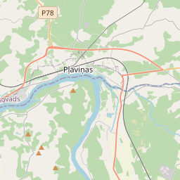
Pļaviņas on the map
Data Sources & Methodology
Our weather forecasts are powered by a professional weather data provider that aggregates data from national weather services, satellite observations, radar networks, and over 80,000 weather stations worldwide. Forecast data is updated multiple times daily. We convert raw data into clear summaries — wind speed in m/s, pressure in mmHg — so you can plan your day with confidence.