Weather forecast Jersika 12-08-2026
Weather forecast Jersika Wednesday, August 12 12.08.2026: patchy rain possible, temperature from 11 °C to 19 °C.
Precipitation probability 30%. Wind up to 6.19 m/s (gusts 7.58 m/s). Air humidity 49–89%, atmospheric pressure 762–768 mm Hg, UV index up to 4.5.
Weather Alerts
Hide alertsHigh temperature up to 34 °C is expected
Moderate high temperature warning
We expect high temperature 33 - 34 °C in district Šaľa,
that represents potential risk for human health during outdoor activities,
particularly for children and elderly people.
BE AWARE that high temperatures are expected.
Some health risks amongst vulnerable people e.g. the elderly and very young are possible.
High temperature up to 33 °C is expected
Moderate high temperature warning
We expect high temperature 33 °C in district Šaľa,
that represents potential risk for human health during outdoor activities,
particularly for children and elderly people.
BE AWARE that high temperatures are expected.
Some health risks amongst vulnerable people e.g. the elderly and very young are possible.
Dzeltenais vēja brīdinājums
10.08.2026. no rīta Baltijas jūras centrālajā daļā dienvidu, dienvidrietumu vējš pastiprināsies brāzmās līdz 15-18 m/s. Naktī uz 11.08. vējš iegriezīsies no rietumiem, ziemeļrietumiem. Viļņu augstums 1.0-2.0 m.
Dzeltenais vēja brīdinājums
10.08.2026. no rīta Baltijas jūras centrālajā daļā dienvidu, dienvidrietumu vējš pastiprināsies brāzmās līdz 15-18 m/s. Naktī uz 11.08. vējš iegriezīsies no rietumiem, ziemeļrietumiem. Viļņu augstums 1.0-2.0 m.
5 days at a glance — tap a day to open it
Sunrise 05:39
Sunset 21:00
Sunset 21:00
New Moon0% illuminated
Moonrise 04:13 · Moonset 20:56
Chart
TableForecast from 11 °C to 19 °C and precipitation
Cloud cover and precipitation probability
Wind speed and direction
Air humidity
Atmospheric pressure
Ultraviolet index
Air quality & pollen
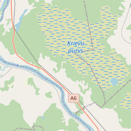
Jersika on the map
Data Sources & Methodology
Our weather forecasts are powered by a professional weather data provider that aggregates data from national weather services, satellite observations, radar networks, and over 80,000 weather stations worldwide. Forecast data is updated multiple times daily. We convert raw data into clear summaries — wind speed in m/s, pressure in mmHg — so you can plan your day with confidence.