Weather forecast Amata Nov 8, 2026

9°4° · Patchy rain possible

Weather forecast Amata tomorrow Nov 8, 2026: patchy rain possible, temperature from 4 °C to 9 °C.

Precipitation probability 31%. Wind up to 3.61 m/s (gusts 9 m/s). Air humidity 71–97%, atmospheric pressure 767–770 mm Hg, UV index up to 0.2.

5 days at a glance — tap a day to open it
Sunrise 07:46
Sunset 16:18
New Moon0% illuminated
Moonrise 06:59 · Moonset 15:15
Chart
Table

Forecast from 4 °C to 9 °C and precipitation

Temperature & Precipitation
Time00:0001:0002:0003:0004:0005:0006:0007:0008:0009:0010:0011:0012:0013:0014:0015:0016:0017:0018:0019:0020:0021:0022:0023:00
Temperature (°C)666665665578899865544445
Precipitation (mm/hr)0.010.020.010.0100.010.010.020.010.0300.010.010.010000000000.01

Cloud cover and precipitation probability

Cloud cover & Rain chance
Time00:0001:0002:0003:0004:0005:0006:0007:0008:0009:0010:0011:0012:0013:0014:0015:0016:0017:0018:0019:0020:0021:0022:0023:00
Cloud cover (%)100100701001007610072628957686873414124381165545382
Rain chance (%)29302329272627212331122019189111319202130282728

Wind speed and direction

Wind & Wind gust
Time00:0001:0002:0003:0004:0005:0006:0007:0008:0009:0010:0011:0012:0013:0014:0015:0016:0017:0018:0019:0020:0021:0022:0023:00
Wind (m/s)2.612.612.812.612.52.612.392.612.392.612.813.193.613.393.613.112.692.392.1122.19222.39
Wind gust (m/s)8.228.116.758.227.616.067.618.225.9798.116.7265.647.336.536.645.256.445.814.535.614.924.78
Wind direction (°)W 279°W 279°WNW 285°WNW 287°WNW 282°W 281°W 275°WNW 297°WNW 289°WNW 283°WNW 289°WNW 300°WNW 298°WNW 297°WNW 298°WNW 284°W 277°W 268°WSW 256°WSW 252°W 259°WSW 249°WSW 242°WSW 248°

Air humidity

Humidity
Time00:0001:0002:0003:0004:0005:0006:0007:0008:0009:0010:0011:0012:0013:0014:0015:0016:0017:0018:0019:0020:0021:0022:0023:00
Humidity (%)878789878592848291928680747271808791969696969793

Atmospheric pressure

Pressure
Time00:0001:0002:0003:0004:0005:0006:0007:0008:0009:0010:0011:0012:0013:0014:0015:0016:0017:0018:0019:0020:0021:0022:0023:00
Pressure (mm Hg)767767767767767767767767768768769769769769769769769770770770770770770770

Ultraviolet index

UV Index
Time00:0001:0002:0003:0004:0005:0006:0007:0008:0009:0010:0011:0012:0013:0014:0015:0016:0017:0018:0019:0020:0021:0022:0023:00
UV Index00000000000.10.20.20.20.10.100000000

Air quality & pollen

Air quality
Time00:0001:0002:0003:0004:0005:0006:0007:0008:0009:0010:0011:0012:0013:0014:0015:0016:0017:0018:0019:0020:0021:0022:0023:00
PM2.5 (µg/m³)3.732.62.62.52.42.42.42.42.52.32222.22.42.73.53.94.456.16.87.5
PM10 (µg/m³)4.74.34.243.63.53.63.73.83.332.82.72.83.133.24.45.56.36.57.38.39.1
Ozone (O₃) (µg/m³)575656555251515251535459656768686866635954524848
NO₂ (µg/m³)1.31.31.31.21.11.11.11.31.41.51.310.90.90.911.11.31.41.82.33.13.74.1
SO₂ (µg/m³)0.10.100000.10.10.10.10.10.10.10.10.10.10.10.10.10.10.10.20.20.2
CO (µg/m³)142141141140140140140141143145145143143143143144144146149151154156160161

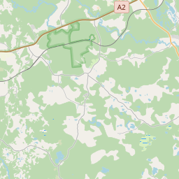
Amata on the map

Data Sources & Methodology

Our weather forecasts are powered by a professional weather data provider that aggregates data from national weather services, satellite observations, radar networks, and over 80,000 weather stations worldwide. Forecast data is updated multiple times daily. We convert raw data into clear summaries — wind speed in m/s, pressure in mmHg — so you can plan your day with confidence.

Top.LV