
Weather forecast Jaunpils Oct 16, 2026
 11°
11°Weather forecast Jaunpils today Oct 16, 2026: overcast, temperature from 6 °C to 12 °C.
Precipitation probability 38%. Wind up to 4.19 m/s (gusts 9.22 m/s). Air humidity 68–96%, atmospheric pressure 767–770 mm Hg, UV index up to 1.2.
5 days at a glance — tap a day to open it
Sunrise 08:03
Sunset 18:23
Sunset 18:23
First Quarter37% illuminated
Moonrise 15:39 · Moonset 20:50
Moonrise 15:39 · Moonset 20:50
Chart
Table
Fri, Oct 16, 2026
| Time | Weather | Temperature | Rain chance | Cloud cover | Humidity | Pressure | Wind | UV Index |
|---|---|---|---|---|---|---|---|---|
| 00:00 |  Mist | 7 °C | 20% | 5% | 95% | 770 mm Hg | SW 214° 2.11 (3.61) m/s | 0 |
| 01:00 | Mist | 6 °C | 20% | 5% | 95% | 770 mm Hg | SSW 197° 2.19 (4.42) m/s | 0 |
| 02:00 | Mist | 6 °C | 35% | 85% | 96% | 769 mm Hg | SSW 197° 2.19 (5.61) m/s | 0 |
| 03:00 | Mist | 6 °C | 38% | 100% | 95% | 769 mm Hg | SSW 193° 2.39 (6.69) m/s | 0 |
| 04:00 | Mist | 6 °C | 38% | 100% | 94% | 769 mm Hg | SSW 201° 2.31 (7.22) m/s | 0 |
| 05:00 |  Overcast | 7 °C | 30% | 93% | 94% | 769 mm Hg | SSW 193° 2.69 (7.92) m/s | 0 |
| 06:00 | Mist | 7 °C | 31% | 72% | 95% | 769 mm Hg | SSW 199° 2.69 (8.61) m/s | 0 |
| 07:00 | Mist | 6 °C | 38% | 99% | 96% | 769 mm Hg | S 186° 3 (8.92) m/s | 0 |
| 08:00 | Mist | 6 °C | 30% | 67% | 95% | 769 mm Hg | SSW 200° 2.81 (8.81) m/s | 0 |
| 09:00 |  Mist | 7 °C | 22% | 26% | 94% | 769 mm Hg | SSW 200° 2.89 (9.22) m/s | 0 |
| 10:00 |  Partly cloudy | 8 °C | 17% | 41% | 88% | 769 mm Hg | SSW 201° 3.11 (9.22) m/s | 0.3 |
| 11:00 | Overcast | 10 °C | 24% | 100% | 80% | 769 mm Hg | SSW 207° 3.69 (8.11) m/s | 0.7 |
| 12:00 | Overcast | 11 °C | 21% | 100% | 75% | 769 mm Hg | SSW 202° 4 (7.83) m/s | 1 |
| 13:00 | Overcast | 12 °C | 19% | 100% | 72% | 768 mm Hg | SSW 201° 4 (8) m/s | 1.2 |
| 14:00 | Overcast | 12 °C | 18% | 100% | 69% | 768 mm Hg | SSW 203° 4.19 (7.81) m/s | 1.1 |
| 15:00 | Overcast | 12 °C | 18% | 100% | 68% | 768 mm Hg | SSW 210° 3.81 (7.61) m/s | 0.9 |
| 16:00 | Overcast | 12 °C | 18% | 100% | 69% | 768 mm Hg | SSW 209° 3.39 (7.42) m/s | 0.6 |
| 17:00 | Overcast | 11 °C | 20% | 100% | 73% | 767 mm Hg | SSW 207° 3 (7) m/s | 0.3 |
| 18:00 |  Cloudy | 10 °C | 18% | 66% | 82% | 767 mm Hg | SSW 199° 2.19 (4.89) m/s | 0 |
| 19:00 |  Cloudy | 8 °C | 23% | 76% | 87% | 767 mm Hg | SSW 197° 2.39 (4.42) m/s | 0 |
| 20:00 |  Clear | 8 °C | 14% | 7% | 90% | 767 mm Hg | SSW 193° 2.39 (5.31) m/s | 0 |
| 21:00 |  Partly cloudy | 7 °C | 21% | 53% | 92% | 767 mm Hg | S 188° 2.39 (5.61) m/s | 0 |
| 22:00 | Cloudy | 7 °C | 24% | 69% | 92% | 767 mm Hg | S 187° 2.5 (6.53) m/s | 0 |
| 23:00 | Overcast | 7 °C | 30% | 95% | 92% | 767 mm Hg | S 181° 2.61 (7.61) m/s | 0 |
Fri, Oct 16, 2026
Frequently asked questions about the weather in Jaunpils
What is the weather in Jaunpils today and what should I wear?
Today in Jaunpils the temperature ranges from 6 to 12 °C, with wind up to 4.19 m/s. Use these values to decide what to wear, and see the hour-by-hour details in the charts above.
Will it rain in Jaunpils today?
The chance of rain in Jaunpils today is 38%. See the hourly precipitation chart above for the exact hours rain is likely.
Is it very windy in Jaunpils today?
Today in Jaunpils the wind rises to 4.19 m/s, with gusts up to 9.22 m/s. Keep that in mind for cycling and outdoor plans; see the hourly trend on the wind chart above.
What are the day and night temperatures in Jaunpils this week?
This week the temperature in Jaunpils ranges from 3 to 13 °C. See the day and night values for each day on the temperature chart above.
Is the weather in Jaunpils good for a walk, cycling or gardening?
For a walk, cycling or gardening, pick the hours with a low chance of rain (up to 38% today) and light wind (up to 4.19 m/s) — compare them on the charts above.
Where does the data come from and how often is the Jaunpils forecast updated?
The Jaunpils forecast is built from meteorological models and updated several times a day. Check back before important plans to see the latest picture.
How far ahead can I trust the Jaunpils forecast?
The first 2–3 days are reliable enough to plan around. Days 4 and 5 are a guide that sharpens as the date approaches. The forecast is rebuilt several times a day, so check again before anything that depends on it.
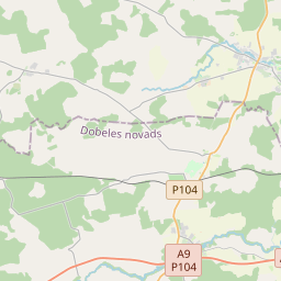
Jaunpils on the map
Data Sources & Methodology
Our weather forecasts are powered by a professional weather data provider that aggregates data from national weather services, satellite observations, radar networks, and over 80,000 weather stations worldwide. Forecast data is updated multiple times daily. We convert raw data into clear summaries — wind speed in m/s, pressure in mmHg — so you can plan your day with confidence.